Birding Sites in the Finger Lakes
STEUBEN COUNTY
State Route 21
This is not a destination. This is a trip. It can be done either by car or by bike. If you start at the northern end, it's pretty much all downhill. It is approximately 15 mi./24 km. and can take however long you want it to--even a long weekend. What birds you see will depend on the season.
From the north
Start at Loon Lake in the Town of Wayland. You can drive the roads near the lake or boat on the lake. In the fields above the lake, look for meadow larks, bobolinks, savannah and grasshopper sparrows, and other field birds. On the lake, look for Canada geese, ring-billed gulls, mallards and other puddle ducks, osprey, the occasional eagle, and herons in secluded spots. At the end of Chapel Road, there is a small wetland that can be scoped for swamp sparrows, red-winged blackbirds, etc. This is technically a private road, so don't overstay your welcome.
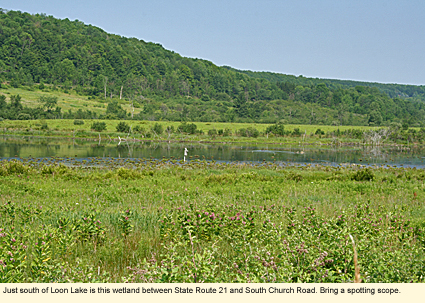
Continuing south on Route 21, you will see on the east side of the road a long, narrow wetland between Route 21 and South Church Road. Look for gulls, wood ducks, herons, swallows, and other wetland birds. There is a red-tailed hawk that lives in the area and likes to sit on the west side of Route 21.
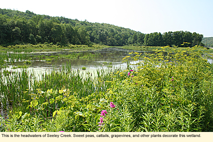
Continue south on Route 21. The wetlands will continue and then turn into Seeley Creek. There will be several pull-off parking areas where you can stop and check for more birds. As trees become more common, look for warblers, vireos, northern orioles, tanagers, rose-breasted grosbeaks, woodpeckers, nuthatches, chickadees, blue jays, and other woodland birds.
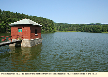
The City of Hornell has three reservoirs along Seeley Creek. Reservoir No. 2 is the most obvious. (Technically it's on Trout Run.) There are places to pull over and walk around, but the property around the reservoir is posted against trespassing. This is also a nice place to have a picnic, though there are no tables. At the intersection of Town Barn Road, there's a dense stand of pines. Look for nuthatches, chickadees, titmice, kinglets, and brown creepers here even in summer.
Just a short distance south on Route 21, take a right onto County Road 57. Check out the reservoirs on both sides of the road. Go to Robinson Road (on the right) and take that until it dead ends. Then retrace your path back to Route 21.
Continue south on Route 21. You will be approaching the City of Hornell, and your birding opportunities will be limited. When Route 21 intersects with State Route 36, turn left. Head south in the city until you intersect with West Main Street. Turn right onto West Main. (You will be going in a northwesterly direction.) West Main is also Route 21.
Follow Route 21 out of the city until you reach Almond Dam Access Road on your right. (You won't miss it as the water of Almond Lake runs near the road.) You are now at Almond Lake, your destination. Look for eagles, ospreys, herons, and other birds in the area around the picnic and camping grounds. Hike the Finger Lakes Trail from the camp grounds for additional birding opportunities.
Keep in mind that most of this trip is rather rural and that, between Loon Lake and the City of Hornell, there are no services.
Have a great trip!
Created 12 October 2010
|
|
|
