Home > Recreation > Nature CentersNature Centers in the Finger LakesTwin Cedars Environmental Area6274 E. Avon-Lima Rd. (State Rts. 5 & 20) Avon, NY 14414 585-732-6060
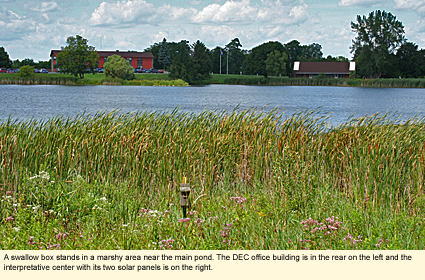
LOCATIONTwin Cedars Environmental Area is owned by the New York State Department of Environmental Conservation (DEC) and is located on the property of its Region 8 office in Livingston County. When you pull into the facility's entrance on the south side of the road, be sure to park in the visitor's parking lot. This will help orient you for the directions below. GENERALThe DEC facility encompasses more than 60 acres of reclaimed farmland, drumlins, and a 20-acre constructed pond separated from another small pond by a dike, and the DEC buildings. The area that's open to the public is only the ponds, the dike around the main pond, and a wild area to the east of the main pond. INTERPRETATIVE CENTERTwin Cedars has an A-frame interpretive center with exhibits and displays. Unfortunately, this facility is closed at least for the near future, but you can always peer in the windows. TRAILSThere are two trails--Turtle Trail and Woodchuck Trail. Both begin and end at the same point. The Turtle Trail is closer to the pond, whereas the Woodchuck Trail is farther from the pond and goes through more shrubby habitat. The total length of both trails is probably about 1.5 mi./2.4 km.
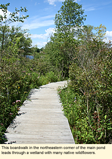
To start, approach the sign board to the left (east) of the interpretative center. On the back of this sign is an aerial map with the trails shown in red. Turn to the left and follow the mowed grass path along the north side of the pond. There are several short unmarked paths that split off here through some dense shrubs and over some short boardwalks where the area is wet. Or you can go straight over a longer boardwalk through a cattail area with some lovely native wildflowers.
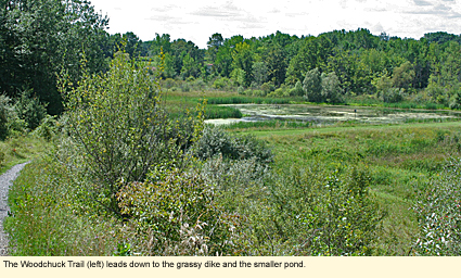
Curve around to your right, and you will come to two signs showing you the Woodchuck and Turtle trails. The trails crisscross and intersect along the way and are not marked to distinguish the two. As you reach the southern end of the main pond on whichever trail you've chosen, you will come to the mowed-grass dike that separates the main pond from the smaller one. Walk this to the western side of the main pond.
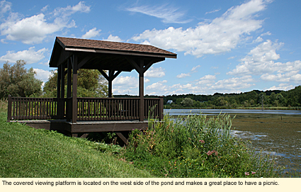
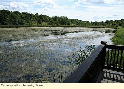
Along the western side is a roofed viewing platform with a bench that makes an ideal spot to have lunch. (There are also picnic tables by the interpretative center.) Continuing along the western side of the pond, you will come to a grassy spit for launching canoes and kayaks. Continue a short distance beyond the spit and you are back at the interpretative center.
ACCESSIBILITYThis area is not really accessible to those with mobility limitations. DOGSDogs are permitted on leash.
PLANTSThe northern white cedar (Thuja occidentalis) is at the southern limits of its range here but is abundant on this property. At the northeast corner of the pond is a small wetland. Here you will find some interesting native plants, including the great lobelia (Lobelia siphilitica). Other plants are fairly typical for the site and the region. ANIMALSThe ponds attract a variety of birds, including Canada geese, great blue herons, ducks, red-winged blackbirds, wax-wings, swallows, and others as well as a variety of reptiles and amphibians. The shrubby areas attract cardinals, catbirds, sparrows, wrens, warblers, etc. Despite the smallness of the area, you should be able to find a wide variety of animals. NEARBY PLACES OF INTEREST
Updated 20 August 2010
|
|
|


